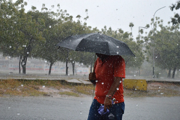
Santo Domingo. - The Dominican Republic's Institute of Meteorology (INDOMET) forecast that the interaction of the east/northeast wind and the trough aloft, in addition to the approach of a tropical wave, will favor a humid environment so that from early morning hours, showers with possible thunderstorms will occur in towns in the regions: northeast and southeast. However, in the afternoon, locally moderate to heavy showers will occur at times, electrical storms and wind gusts in locations in the portions: northeast, southeast, Cordillera Central, border area and Cibao Valley.
Similarly, temperatures will remain hot, for this reason, we suggest drinking enough water, wearing light-colored clothing, and avoiding sun exposure for prolonged periods without protection, mainly from 11:00 a.m. to 4:00 p.m.
Cyclonic activity in the Atlantic basin, Caribbean Sea and Gulf of Mexico or America:
A low-pressure area located several hundred kilometers southwest of the Cape Verde islands is being monitored, which has a medium (50%) and high (70%) potential in the next 2 days to develop into a tropical cyclone in the next 7 days. Due to its geographical position, the evolution and development of this system is being followed.
National District: cloudy increases with showers and thunderstorms.
Santo Domingo Norte: Increased cloudiness with showers and thunderstorms.
Santo Domingo Este: partly cloudy with showers and thunderstorms.
Santo Domingo Oeste: Slight cloud increases with showers and thunderstorms.
Temperatures: the minimum will be between 21 °C and 23 °C and the maximum between 33 °C and 35 °C.
Summary: Dangerous waves on the Atlantic coast, vessels should remain in port and bathers should consult the authorities before carrying out their recreational activities... Upper-level trough and the effects of the east/northeast wind, producing showers with electrical storms and wind gusts, over the regions: northwest, north, northeast, southeast, Central Mountain Range and border area... A low-pressure zone associated with a tropical wave with high cyclonic potential in 7 days is being monitored.
For Wednesday, the tropical wave will be over our territory, which together with the interaction of an upper-level trough, will maintain a humid and unstable environment so that during the afternoon moderate to heavy showers, thunderstorms and wind gusts will occur over the regions: northeast, southeast, Central Mountain Range and border area.
National District: Cloudy increases with local showers, thunderstorms and possible wind gusts.
Santo Domingo: Cloudy increases with local showers, thunderstorms, and possible wind gusts.
PROVINCES FORECAST BY LOCALITIES T. Max. °C T. Min. °C
Santiago Increasing cloudiness with showers, thunderstorms and wind gusts. 33/35 21/23
Puerto Plata Cloudy with showers with thunderstorms. Recommendation for abnormal waves. 31/33 22/24
Duarte Scattered clouds with slight cloud increases with scattered showers. 31/33 22/24
Constanza Increasing cloudiness with local showers, thunderstorms and possible wind gusts. 26/28 13/15
Peravia Slight cloud increases with passing showers. 31/33 21/23
San Pedro de Macorís Increasing cloudiness with scattered showers and thunderstorms. 31/33 21/23
La Romana Slight cloud increases with scattered showers and thunderstorms. 31/33 22/24
La Vega Increasing cloudiness with local showers, thunderstorms and possible wind gusts. 33/35 21/23
Monseñor Nouel Increasing cloudiness with local showers with thunderstorms and possible wind gusts. 31/33 21/23
San Cristóbal Slight cloud increases with passing showers. 31/23 21/23
Samaná Increasing cloudiness with isolated showers. 31/33 22/24
Monte Cristi Scattered to partly cloudy at times. 33/35 23/25
Azua Increasing cloudiness local showers, thunderstorms and possible wind gusts. 31/33 21/23
San Juan Partly cloudy with local showers, thunderstorms and possible wind gusts. 30/32 18/20
Barahona Scattered to partly cloudy with showers. 31/33 21/23
La Altagracia Partly cloudy with showers and thunderstorms

 Spanish


